MANILA(June 18) — A new low-pressure area (LPA) forming over the Pacific Ocean is being closely monitored by weather authorities, raising fresh questions about the country’s vulnerability to heavy rains and flooding as the rainy season gains momentum.
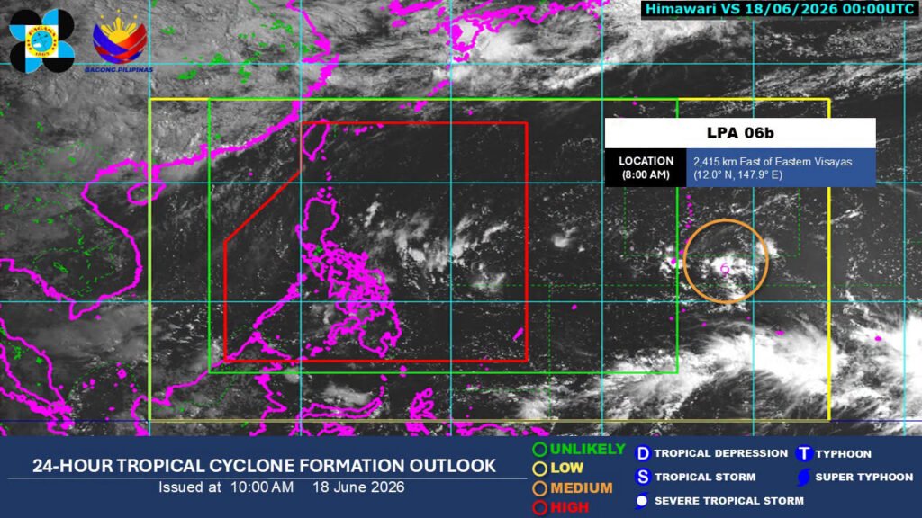
The Philippine Atmospheric, Geophysical and Astronomical Services Administration (Pagasa) said Wednesday that the weather disturbance, located about 3,060 kilometers east of northeastern Mindanao, currently has a medium chance of developing into a tropical depression.
For now, forecasters say the system remains far from the country and is not expected to directly affect Philippine weather. However, weather experts caution that its future movement could still influence rainfall patterns in parts of the country.
According to Pagasa, one possible scenario is that the disturbance enters the Philippine Area of Responsibility (PAR) while remaining far enough away to avoid a direct impact. Another possibility is that it curves northward and away from the country but strengthens the southwest monsoon, or habagat, which can bring days of rain and trigger flooding in vulnerable areas.
While the storm’s path remains uncertain, the forecast serves as an early reminder that weather systems do not always need to make landfall to cause problems on the ground.
Even without the developing weather disturbance, several areas in eastern Mindanao and Eastern Visayas are already experiencing unstable weather due to the easterlies—warm and humid winds coming from the Pacific Ocean.
Pagasa identified Eastern Visayas, Dinagat Islands, Surigao del Norte, Surigao del Sur, and Davao Oriental as areas likely to experience cloudy skies and isolated rain showers or thunderstorms.
Although these rain events may appear localized, they can quickly become dangerous.
Weather specialist Chenel Dominguez warned that severe thunderstorms could trigger flash floods and landslides, particularly in low-lying, flood-prone, and mountainous communities.
For residents in Mindanao, the warning carries added significance. Recent years have shown how sudden and intense rainfall can overwhelm drainage systems, flood communities, damage crops, and isolate villages even without the presence of a strong tropical cyclone.
Beyond Storm Tracking
Meteorologists note that public attention often focuses on named storms, but many weather-related disasters occur during ordinary thunderstorms and monsoon rains that receive less attention.
This reality highlights the need for communities to remain vigilant even when forecasts indicate only isolated rain showers.
Disaster risk reduction advocates emphasize that preparedness should not begin when a tropical cyclone enters the PAR. Monitoring local weather advisories, clearing drainage systems, identifying evacuation routes, and paying attention to warnings from local authorities can significantly reduce risks.
Rainy Season Challenges
The emergence of another weather disturbance also underscores the broader challenge facing many Philippine communities: adapting to increasingly unpredictable weather patterns.
Scientists have observed that warmer oceans can contribute to more intense rainfall events, even from weaker weather systems. As a result, communities are experiencing floods, landslides, and weather-related disruptions with greater frequency.
For farmers, fisherfolk, and residents living in hazard-prone areas, every new weather disturbance becomes a reminder of the importance of preparedness.
While the low-pressure area remains far from the country, weather officials are expected to continue monitoring its development over the coming days.
For now, Pagasa advises the public—especially residents in Eastern Visayas and eastern Mindanao—to stay updated with official forecasts and remain alert for sudden thunderstorms that could bring heavy rain despite generally fair weather conditions elsewhere in the country.

