
MANILA (October 2) — The Philippines, which has just recovered from the September triple storms, is getting ready for another one as “Paolo,” the 16th tropical cyclone, formed on Wednesday morning, October 1, east of Catanduanes.
Tropical Depression Paolo was last seen 760 km east of Virac, Catanduanes, with maximum sustained winds of 45 kilometres per hour (kph) and gusts of up to 55 kilometres per hour.
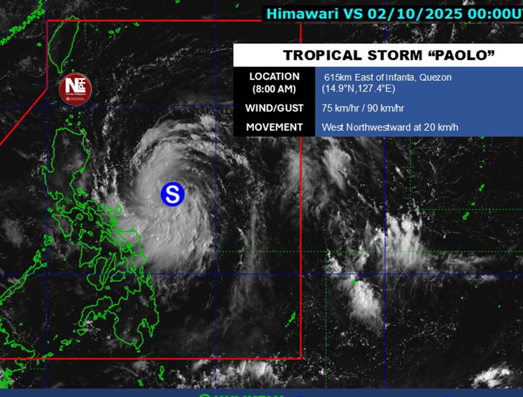
Paolo formed around 8 a.m. on Wednesday, only 12 hours after the low-pressure system entered the Philippine area of responsibility (PAR).
It is now heading west at 25 kph, with powerful winds stretching up to 360 kilometers from the center.
There were no wind signals raised as of 11 a.m., but PAGASA stated that Signal No. 1 might be hoisted as early as Wednesday afternoon or evening.
Heavy rain is predicted by Friday, October 3, however it is unlikely that the tropical depression will have an immediate impact on local weather in the next 24 hours.
According to PAGASA, Paolo is expected to make landfall on Friday in Isabela or northern Aurora in the morning or afternoon. While the storm is expected to cross Luzon, the meteorological agency warns that its path may change southward.
The cyclone is anticipated to intensify further over Philippine waters, probably reaching severe tropical storm status by Friday and possibly strengthening into a typhoon before making landfall.
Wind Signal No. 3 may be the strongest warning issued when Paolo crosses the country, although Signal No. 4 is likely if the storm grows into a typhoon.
According to PAGASA, up to four tropical cyclones might enter PAR in October.
