
BUTUAN CITY (November 3) — The Philippine Atmospheric, Geophysical and Astronomical Services Administration (PAGASA) has raised higher wind signals in parts of Mindanao as tropical cyclone “Tino” strengthened into a typhoon on Monday morning, November 3.
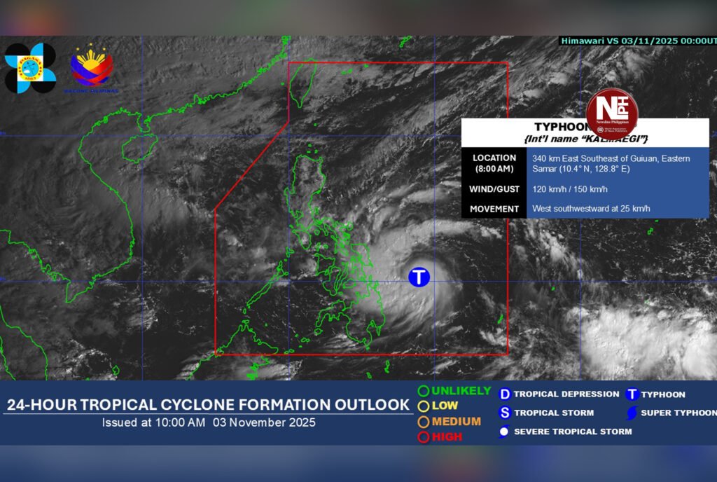
As of 11 a.m., Tino was located 285 kilometers east-southeast of Guiuan, Eastern Samar, packing maximum sustained winds of 120 kilometers per hour (kph) and gusts of up to 150 kph while moving west-southwest at 25 kph.
Signal No. 3 up in parts of Caraga
PAGASA hoisted Signal No. 3 over the following areas:
- Dinagat Islands
- Northern Surigao del Norte, including Surigao City, Siargao, and Bucas Grande Islands
These areas are expected to experience storm-force winds within 18 hours, with heavy damage likely to high-risk structures and houses made of light materials. Power and communication lines may be disrupted.
Other areas under lower wind signals
Signal No. 2 covers the rest of Surigao del Norte, the northern part of Surigao del Sur (Carrascal, Cantilan, Madrid, Carmen, Lanuza, Cortes), the northeastern portion of Agusan del Norte (Kitcharao, Jabonga, Santiago, Tubay, Cabadbaran City), and the northern portion of Camiguin (Mambajao).
Signal No. 1 is up over the rest of Surigao del Sur, Agusan del Norte, Camiguin, Misamis Oriental, the northern parts of Bukidnon, Misamis Occidental, and Zamboanga del Norte, as well as parts of Agusan del Sur.
Even areas not under direct signals could still experience strong to gale-force gusts due to the combined effects of Tino and the northeast monsoon, PAGASA warned.
Coastal risks, high waves
The weather bureau cautioned against life-threatening storm surges and very rough seas in Dinagat Islands, Surigao del Norte, Surigao del Sur, Agusan del Norte, Misamis Oriental, and Camiguin within the next 48 hours.
Waves along the eastern seaboard of Dinagat and the northern and eastern coasts of Siargao and Bucas Grande Islands may reach up to nine meters, while other coastal areas in the Visayas and northern Mindanao may experience five- to eight-meter waves.
Expected landfall, track
Typhoon Tino is projected to make landfall Monday night or early Tuesday (November 4) over southern Eastern Samar, Leyte, Southern Leyte, or Dinagat Islands, before crossing the Visayas and northern Palawan toward the West Philippine Sea by Wednesday.PAGASA said Tino may intensify further into a super typhoon, bringing heavy rain, flooding, and possible landslides in parts of Caraga and Northern Mindanao.
